Description
Condition Notes: This Moab West Topographic Recreation Trail Map is in good condition, showing signs of previous use but still functional for its intended purpose.
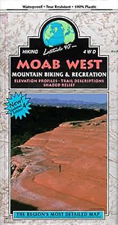
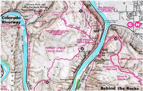
Moab, Utah, is a renowned outdoor recreation destination, attracting adventurers from around the world to explore its stunning red rock landscapes and challenging trails. This topographic map, published by a trusted cartographic source, is an essential companion for hikers, mountain bikers, and off-road enthusiasts venturing into the rugged terrain west of Moab.
Meticulously crafted with detailed contour lines, trail networks, and terrain features, this map provides invaluable guidance for navigating the intricate web of canyons, slickrock formations, and backcountry routes that define this region. Whether tackling the iconic Slickrock Trail or discovering lesser-known gems, this map empowers outdoor enthusiasts to plan their adventures with confidence and explore the area’s natural wonders safely.
For collectors and outdoor enthusiasts alike, this well-used copy bears the marks of countless adventures, carrying the spirit of exploration and a connection to the breathtaking landscapes it has helped unveil. Its creased folds and weathered edges are a testament to the countless miles trekked and the memories forged amidst the rugged beauty of Moab’s western expanse.
![PERRY MASON CASE OF THE STUTTERING BISHOP ERLE STANLEY GARDNER Pocket 1936 1960 [Hardcover] Erle Stanley Gardner [Hardcover] Erle Stanley Gardner](https://vintagebookshoppe.com/wp-content/uploads/imported/PERRY-MASON-CASE-OF-THE-STUTTERING-BISHOP-ERLE-STANLEY-GARDNER-Pocket-1936-1960-Hardcover-Erle-Stanley-Gardner-B08L6JV9TY-324x490.jpg)